


What is Satellite and Airborne Remote Sensing?
Satellite and airborne remote sensing gives us vital ocean observations. They measure properties like sea level, currents, winds, sea surface temperature, ocean colour, salinity, waves, and sea ice. These data help us spot patterns in ocean circulation, how heat and freshwater move around the planet, how air and sea interact, and biological activity. All of this deepens our understanding and helps shape strategies to tackle climate change and extreme hazards.
This research provides new and better observations everywhere, from coastal, shelf, and polar seas right out to the open ocean, even covering remote and hard-to-reach areas. Remote sensing fills crucial gaps in our ocean observing system. This work supports key scientific goals, from climate prediction and reducing the impacts of marine hazards to managing resources sustainably and protecting ocean health.
What impact does Remote Sensing research have and why is continued investment important?
This research has a huge impact beyond just science. These advancements lead to real-world benefits: safer seas, healthier ecosystems, better food, water, and energy security, and more resilient communities worldwide. The new and improved observations sharpen our understanding of ocean change and make predictive models more accurate.
This work keeps the UK at the cutting edge of global ocean observation. Through our involvement in big international projects like SWOT and our own NOC-led SeaSTAR mission idea, we are driving innovation in new sensors and platforms. We do this by partnering with academia, industry, government, across the aerospace, digital and environmental science sectors.
Continued investment in ocean remote sensing R&D is vital. It allows us to maintain and enhance key observing capabilities, like the Copernicus Sentinels, and ensures our ocean observations can keep up with the data needed by scientists and forecasting services to monitor and respond to our changing ocean.
What research projects are NOC conducting?
At NOC, our remote sensing R&D combines advanced spaceborne and airborne platforms and sensors with modeling and direct (in situ) observations. This integrated approach helps us fill critical gaps in what we can currently observe.
Research Projects
We lead the UK's contribution to the Surface Water and Ocean Topography (SWOT) mission. We are working with Bristol and Bangor Universities to see how well SWOT's water-level imaging works in coastal areas and estuaries. This cross-disciplinary project (PI: Paul Bell), supported by NERC and the UK Space Agency, brings together remote sensing, hydrology, coastal modeling, and stakeholder engagement. The main goal is to test SWOT's ability to map surface water and ocean topography in the UK's challenging, flood-prone, hyper-tidal regions, like the Bristol Channel.
Learn MoreThe ESA-funded CryOcean-QCV project (led by PI: Chris Banks) uses data from the CryoSat-2 ice mission to observe and study the ocean. After validating the satellite data against in situ tide gauges and wave buoys, the data are compared with models to give us new insights into global sea-level and wave dynamics.
The ESA Sea State Climate Change Initiative (PI: Ben Timmermans) uses reprocessed satellite altimeter and SAR measurements of ocean surface waves from multiple missions spanning over 30 years. The goal is to look at long-term (multi-decadal) changes in the global wave climate, focusing especially on how these changes affect coastal areas. We are working on this with international partners, including Ifremer, Technical University of Munich, German Aerospace Centre (DLR), and ECMWF.
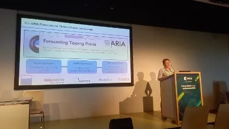
Learn MoreThe ARIA-funded AEROSTATS project (PI: Christine Gommenginger) is exploring remote sensing from autonomous airborne platforms, like drones, airships, and high-altitude pseudo-satellites. The aim is to show we can get sustained observations (multiple times a day) of ocean currents, winds, heat and freshwater exchanges happening between the Greenland Ice Sheet and the North Atlantic subpolar gyre.
The project pulls from NOC's expertise in remote sensing, numerical modeling, AI, and autonomous underwater systems. We are working with industry partners, including Radarmetrics (Spain), NOVELTIS (France), and Pixalytics Ltd (UK), to build new capabilities that will improve our understanding of critical oceanic transports and air-ocean-ice interactions.
Learn MoreWhat outcomes has this research delivered?
NOC's research has already had a huge impact on how different ocean systems and processes affect our planet and the difference climate change is making. Here are some key outcomes:

SAR Altimetry Breakthrough
NOC's research in ocean remote sensing has delivered major advances that completely reshaped how we observe the ocean from space and air. A key breakthrough was demonstrating Synthetic Aperture Radar (SAR) altimetry over the ocean using CryoSat-2 data. We showed it could provide higher-resolution, more precise measurements much closer to the coast than ever before.
Working with international experts (Gommenginger et al., 2013), this research established SAR altimetry as the new standard (the default mode) for all new satellite altimeters, including Sentinel-3, Sentinel-6 Michael Freilich, and the upcoming CRISTAL mission. These advances are now the foundation for global monitoring of sea level and ocean circulation. They provide vital data for ocean forecasting and sea-level rise projections that directly impact people and ecosystems.
SWOT
NOC has played a leading role in evaluating the SWOT mission. We were amongst the first to demonstrate the value of its swath altimetry right across the "land-ocean continuum," meaning the connected system of rivers, estuaries, and the coastal and open ocean. SWOT has given us unprecedented insights into how water levels vary spatially (in 2D) at scales smaller than a kilometer.
Early assessments confirmed that SWOT performs at least as well as CryoSat-2 (Lichtman et al., 2025). This paves the way for transformative studies on coastal flooding, estuary dynamics, and the freshwater-saltwater exchanges that affect marine habitats and local communities.
SeaSTAR Mission
Another major outcome is NOC's leadership of the SeaSTAR mission concept. SeaSTAR introduced a new way to map total surface currents and winds instantaneously. It is widely supported internationally (Gommenginger et al., 2019) and has already been successfully proven in airborne trials (McCann et al., 2024). SeaSTAR continues to be a major driver of innovation.
SeaSTAR is now focused on autonomous airborne platforms. The goal is to get sub-daily, sub-kilometer observations of ocean dynamics, which is beyond what current satellites can do. This work is central to building a sustained, net-zero system for observing the ocean. The AEROSTATS project is currently testing its potential as part of an early warning system for tipping points in the North Atlantic.
What future applications exist?
Across all these projects, NOC brings together international partnerships, multi-platform observations, and advanced modeling. This combined effort helps us improve our understanding of ocean dynamics, boost our monitoring capabilities, and support both climate resilience and better-informed decision-making.
Looking ahead, this kind of autonomous airborne capability, and low-cost New Space satellite missions like HydroGNSS hold huge promise for transformative monitoring of the ocean, particularly polar seas (like the Arctic) and coastal waters. In these areas, getting persistent, wide-area (synoptic) mapping is difficult, but it is essential for tracking change, protecting infrastructure and ecosystems, and supporting climate resilience.
Scientific Publications

Interested in Learning More?
Interested in learning more about satellite and airborne remote sensing or accessing ocean observation data? Explore NOC's innovative approaches to monitoring the ocean from space and air.